


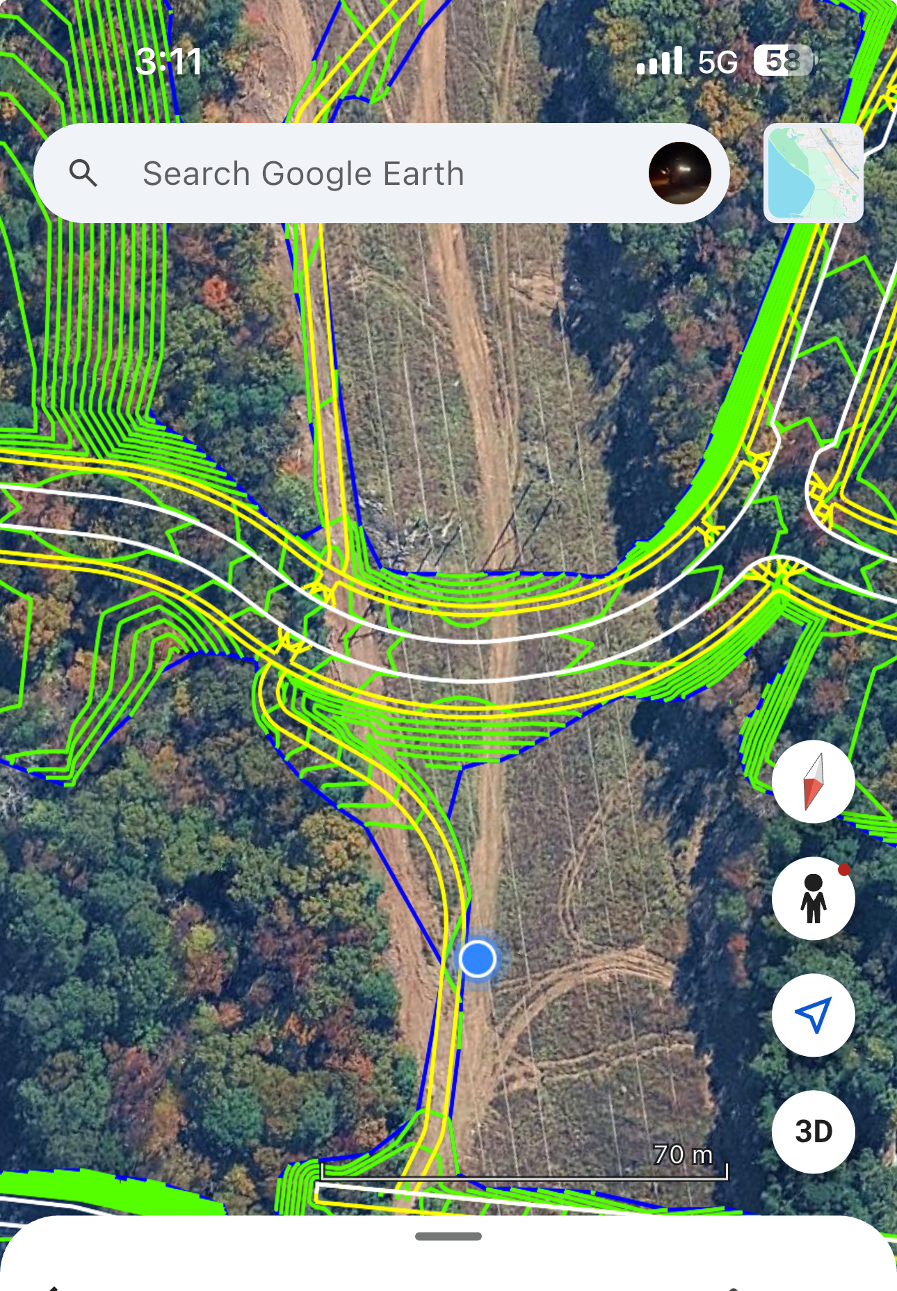
KML Importing to overlay on google earth
I currently have discovered this function in another program and discovered how beneficial it really is to use when mapping and planning out jobsites especially when it comes to utilities and earthwork. Basically you take all of the takeoff data and put it into a KML file with coordinate data provided from the user or a georeferenced CAD file if you eventually integrate CAD file importing. Once you have a KML file that is properly positioned through GIS you can import into google earth and get something like the example below.
Interesting that you bring this up, I've been doing a lot of coding with AI and came up with my own software for importing plans to google earth:
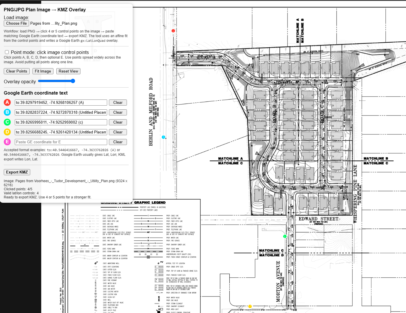
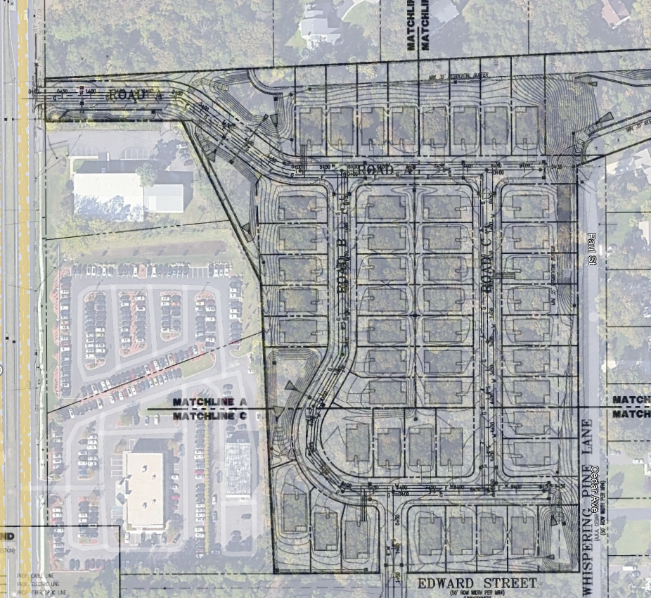
I'm currently working on a way to bring the whole takeoff to GE as well.